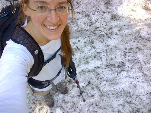
Last Friday I set off for a long-overdue solo tramp in the Vosges. I chose walk no. 24 – Le Ban de la Roche – in my favorite Vosges guide: Randonner avec les TER published by the Club Vosgien in 2003.
 I had planned to take the 7am train to Rothau, but the night before I had worked until nearly 2am. No big deal – I got an extra hour of sleep and took the 8:55am train from Strasbourg. I arrived at Rothau just before 10am.
It took me a bit of time to locate the first blaze – a yellow triangle. Occasionally the blazes start out at the train station, but in this case didn’t. When in doubt, I’ve learned, go to the church. And that’s what I did.
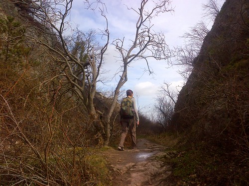
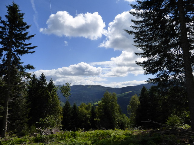
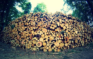
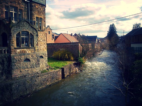
The village of Rothau is nice enough. I didn’t spend enough time there to see much. It has two lovely churches and a major high way that runs right through town, which made walking along the narrow sidewalks feel a bit like playing Russian roulette. So I was happy to make my way into the forest and climb out of the valley. After leaving behind the last house on a gravel road, I found a dirt path that wound around the side of the mountain. A canal ran alongside the path where a few ducks were swimming in the morning sun.

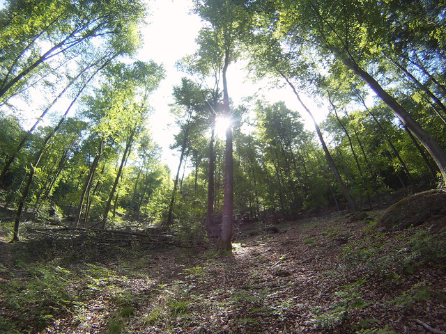
Nature was slowly and carefully waking up on the mountainside. Tufts of grass were peeking out from piles of leaf rot and fallen branches. Tree saplings reached for the sunshine. The mosses covering the rocks were especially pretty with fine stalks sporophytes. I saw an owl swoop across the trail. There was a woodpecker hammering away at a tree above my head.
I hiked for about two hours before I came to a sign directing me to the Cascade de la Serva. It was a steep hike up to reach the most impressive section of the waterfall. 
The waterfall was gorgeous. The roar of the water was nearly deafening. The temperature fell as the relative humidity rose. I could smell the damp rocks. The trail climbed even steeper as it wound around and followed the waterfall to its source at the top of the Champs du Feu.
I couldn’t resist taking off my shoes to feel the ice-cold water on my feet. So I found a sunny spot next to the water . Had it been a bit warmer, I probably would have been tempted to take a dip in my skivvies in one of the small pools.
I couldn’t stop here too long – I still had about 15 kilometers left.
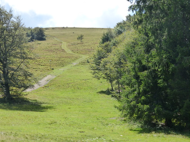
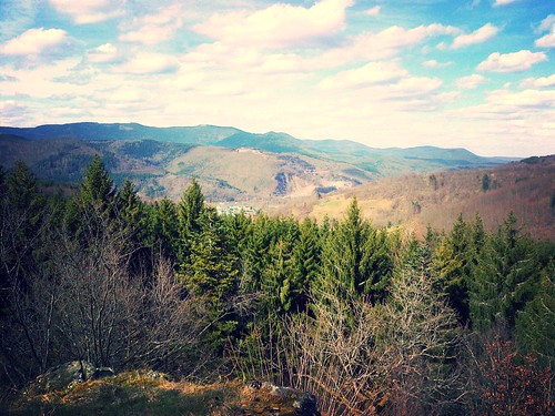
I walked through a forest of naked deciduous trees. This still made it possible to see across the valley to the mountain ahead. Up I climbed to the Champs du Feu.
 Well…sort of. I was headed in the direction of the Champs du Feu, but lost my trail at a wild intersection of trails. I spent about 2km figuring out that I was headed in the wrong direction.
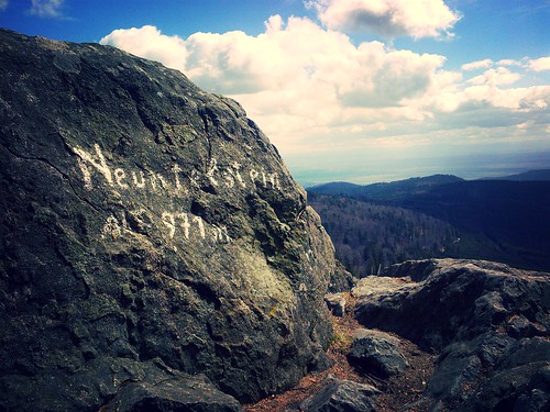
I eventually made it to the Champs du Feu – a ski station in the Bas-Rhin. The last bits of snow had become sheets of ice on the trail, which made it tricky for descending to the Col de la Charbonnière before lunch was over!
I didn’t think that lunch was going to be spectacular, but I was mistaken. I ordered the soupe de jour and a portion of cheese. I didn’t think that the presentation would be so spot on or that the serving would be so generous. The meal was just what I needed to power me over the next 10 or so kilometers to Saint-Blaise-la-Roche.
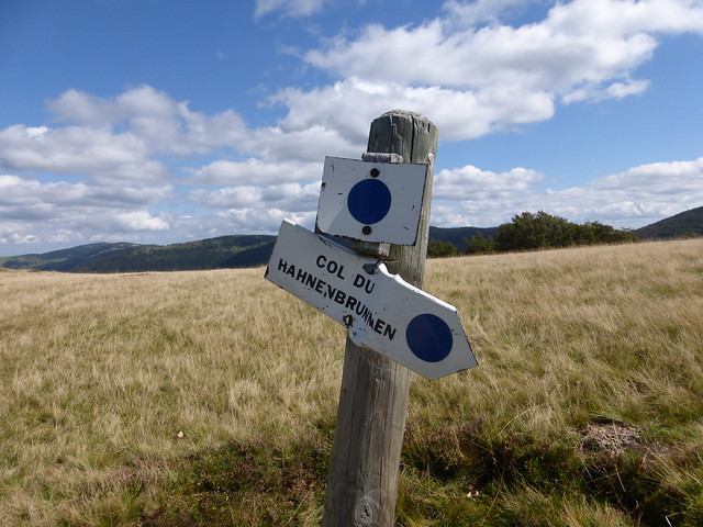
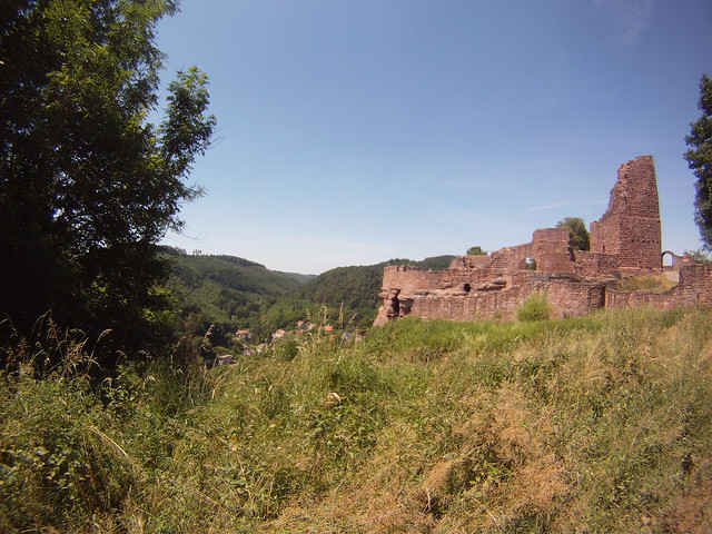
The guide indicated that an old castle ruins was ahead, but didn’t give a description of what exactly I should be looking for.
When I made it to the ruins I understood why it was called château de la Roche and was puzzled why the guide book only mentions it, but doesn’t have it marked out on the map. The donjon or stone keep of this 12th century castle was built on a granite rock jutting up to the sky. The Club Vosgien built a steep 105 step staircase that winds around to the top of the donjon ruins. From the top is a gorgeous view of the neighboring hillsides and valleys and a frightful walk down.
 The rest of the hike was literally all down hill from that point. I crossed a field with pen full of lamas and then found a forestry road that led me to the edge of Saint-Blaise-la-Roche. At the highest part of town were mostly farmers’ granges with large farming equipment parked inside. Further down, the homes took on the typical Alsatian style with half-timbered fronts and large well-manicured gardens ready for spring planting.
I found the train station with a bit of help from a local and waited a half an hour for my train back to Strasbourg. I was physically tired, but I felt amazing. My legs felt stronger and my mind felt a bit clearer.

Rothau to Saint-Blaise-la-Roche Total: 22km / +650m

 A few weekends ago, I took a solo hike across the Grande Crête des Vosges (crête is the French word for mountain ridge). What a glorious day it was! It was an easy 25 or so kilometers from start to finish with around 900 m of elevation gain (that kicked my butt).

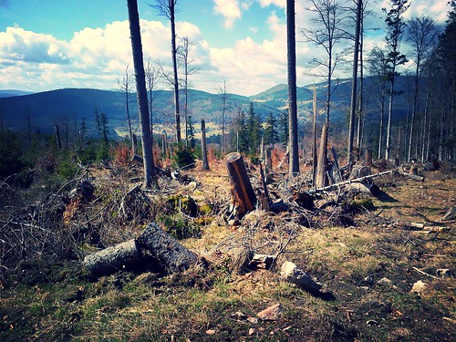
 I thought that it would be best to start my hike as early as possible to avoid the heat of the day and also the predicted afternoon showers. The bus dropped me off in Lièpvre at 7:40 am. The first 5k was on forestry roads through the forest at a rather steep pitch. The blazes were unclear, which meant I had to pay attention with all crisscrossing forestry roads. I eventually made it to the Rotzel shelter, where the road ended in a massive sort of gravel parking lot.
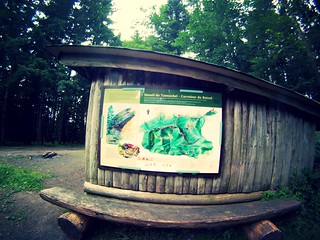 The shelter was pretty basic with an old picnic table…though the surroundings weren’t so great for a picnic. Up to this point I was feeling a bit discouraged. I had been walking on a road wide enough for two cars and stumbled on a parking lot. Just my luck! But behind the shelter was a “Tranquility Zone” sign. It means that there are no cars and no hunting allowed in the area. Nature was finally left to her own devices…
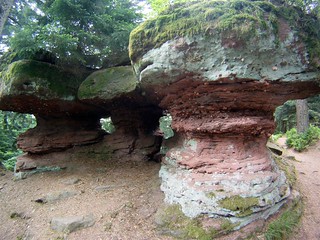
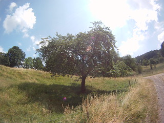 However, there was a reward for the effort. Just before going under a bridge to rejoin Sainte-Croix-aux-Mines, where I caught the bus back to Séléstat, I happened upon the most beautiful cherry tree. The fruit was ripe and hanging low. How could anyone resist tart, sweet, tree-ripened cherries?
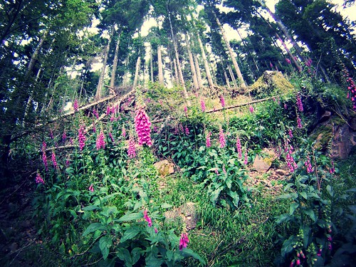
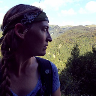
 It was supposed to be a super scorcher in the Lower Rhine on our hiking day, so my trusty walking partner Stefanie and I took the 6:50 a.m. train to Lutzelbourg in order to avoid walking in the heat all day. Neither of us had slept the night before for whatever reason. We must have looked like hell to the commuters on the train. No bother, the day was gorgeous.
 The hike literally starts as you leave the train station…well about 100 meters away. Up we went to the chateau of Lutzelbourg. Then we were on a constant up and down rocky path for the next few hours. While we were in the forest above Lutzelbourg we crossed two walkers, who were in their 60s, with dogs. We chatted a bit and I told them how I was using my favorite hiking book for the Vosges (it’s by the Club Vosgien for hiking and using the regional train). One of the walkers, surprised that I knew the book, told us that had he helped write the section that we were walking. I should have told him that a few of the instructions for the hike were a bit vague, but I instead just gave him my compliments.
 Halfway through we started naming animals we would like to see on our walk. We were excited to see two gigantic hares crossing the path ahead of us as though they were leading the way. We frightened a young deer that leapt in front of us only a few feet away. Then jokingly I said that my day would be complete if I could see a snake. A few minutes later Stefanie yelled up ahead…a snake! Turns out it wasn’t a snake, but a legless lizard called a slow worm (Orvet fragile in French). Nonetheless we got to see a new reptile that I’d never seen in the Vosges.
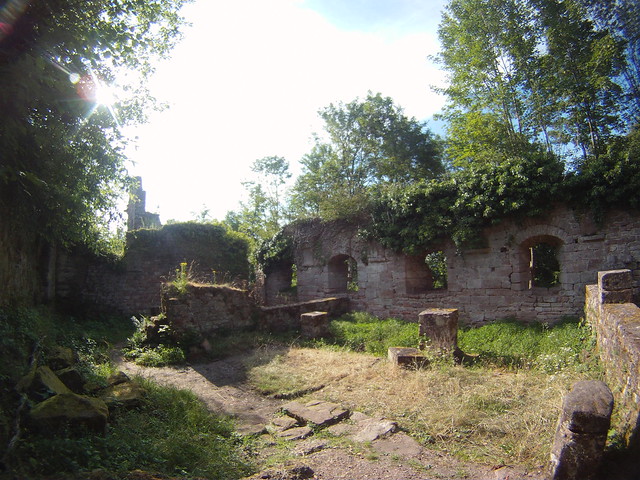
 The most beautiful portion of the hike was discovered at a chateau ruins called Grand Geroldseck not far from the chateau of Haut-Barr. It was as if we had stepped into a fairytale ruins once we climbed the stairs that had been laid 900 years earlier. A rebuilt dungeon tower and the skeleton remains of a once expansive chateau were perfectly laid out. You could walk along the interior walls and down steps, wander through archways. The water well was still visible. Flowers, nut trees and tall grasses had taken over most of the open spaces, while stinging nettles filled the lowest levels of the ruins. Nature was now king of this castle and it was good.


 At the University of Strasbourg, there is an organization called SUAPS – it offers different kinds of sports activities for students and staff. On Saturdays during the school year, SUAPS organize hikes. Depending on the size of the group or location of the hike, we either take a shuttle bus or the regional train (TER). I went on the first 2013 season hike the first Saturday of April.
 low in the sky that I had the perpetual feeling of nightfall. The temperatures were pretty low too. I was well prepared for the weather, but there were several in our group who were less prepared and suffered the cold.
 I made sure the Easter bunny had left a trail of sweets before sneaking out to catch the early train to Barr for an Easter Sunday hike with Violaine.
 The weather forecast wasn’t very promising when I had a look the night before – clouds with a chance of rain – but I held out for blue skies (I put my faith in a weather report about as much as my horoscope). The sun did come out for a bit. We even had to remove a few layers – before putting them back on an hour later once the wind started blowing and the clouds came…and a few flurries.
 I guess you could call Saturday’s outing the kickoff of for my 2013 – Walks in the Vosges.